


Out of stock
BOK597
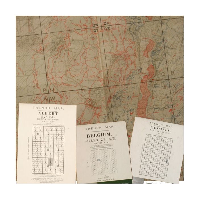
Pack 01 WW1 Trench Maps, Belgium ST 28, Albert, Messines
£9.75
£9.75
Pack of 3 reprints of British WW1 Trench Maps
Includes:
Trench map Belgium No 28:
- Smaller scale Map of the whole area of 28
- Map dated 9-6-16
- Famous Battle of Ypres/ Passchendale
- Famous Places named, Hell Fire corner, Hill 60, Hooge, Sanctuary wood
- Towns on map: Ypres and Poperinghe
- Trenches British & German
- Map Size 23 x 16 inches
Trench map Albert 57d SE:
- Albert , France
- Map dated 23-7-18
- Famous battle Battle of the Somme
- Date of Battle 1st July 1916
- Albert was behind British lines and was the build up point
- Towns on map: Albert
- Trenches British & German
- Map Size 23 x 16 inches
Trench map Messines Part of 28:
- Messines ridge
- Map dated 9-4-16
- Famous battle 3rd Battle of Ypres/ Passchendale
- Date of Battle 11th July 1917
- Towns on map: Messines, Wytchaete
- Trenches British & German
- Map Size 23 x 16 inches
| Weight (g) | 100.00 |
|---|---|
| Restricted Product? | No |